Quainton
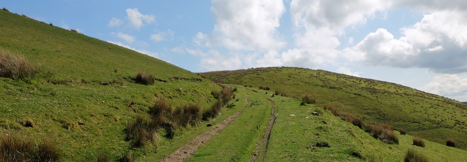
There is rich pasture on the hill above Quainton (SP 745203) but that's just about all. Cattle and an occasional farmhouse were the only signs of life – and we got severely lost.
Lucky we did. The farmer who told us where we were also told us about the geology of the area. Quainton Hill has “a greensand cap on top of heavy Oxford clay”. Where clay meets cap is a ring of springs fed by rainwater percolating through the greensand. (At this moment, the farmer's wife brought us two glasses of delicious spring water, which proved the point.) Anyway, the result is lush pasture, most of which has never been ploughed.
(Some of it was ploughed, during WW2. The man who farmed the area had hated the thought of it, but the Man from the Ministry had threatened him with prison if he didn't. In the end, his wife got on the tractor, but the slope was so steep that she turned it over and damn near killed herself.)
Then the farmer said, “A very old road goes up over the hill from our farm then down into Quainton.”
How old? I never asked that question, but I think he meant pre-Roman. Do you ever get that feeling, walking through the countryside, that it's all incredibly ancient and almost “wise”, and that you're an intruder? That's what we felt like that afternoon.
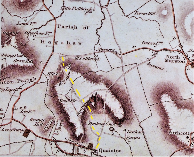
I've marked the route we took on Bryant's 1828 map, in yellow (#1), but the route Bryant shows has no bend in it, whereas the bend is obvious as you climb up from the farm (#2). “Aim for the summit,” the farmer had said; which was easy (751213) because it's marked by a mini Eiffel tower. Another intruder.
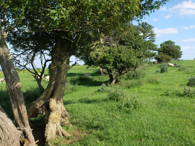
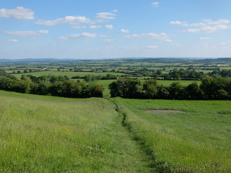
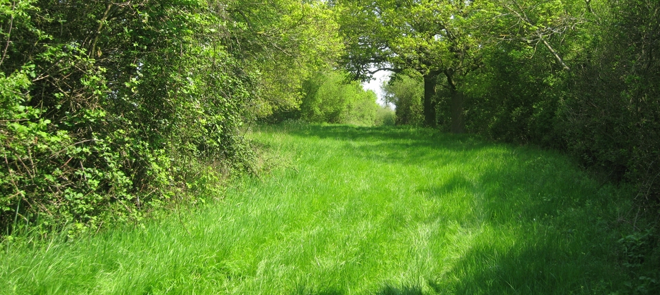
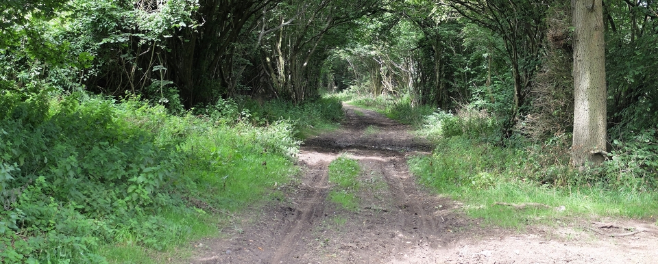
Nearer the summit, we saw hawthorns (#3) marking an old trackway, which always gets us excited. Then, past the summit came a wide farm track & cultivation (for a field or two) and a view of the whole of South Bucks with The Chilterns blue in the distance (#4).
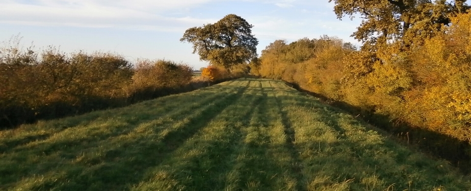
We took 46 snaps of that great view. The only place we couldn't see was Quainton, the village we were aiming for. It was always in a dip or round a bend behind trees, till we began to think it had disappeared.
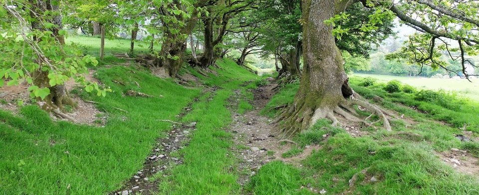
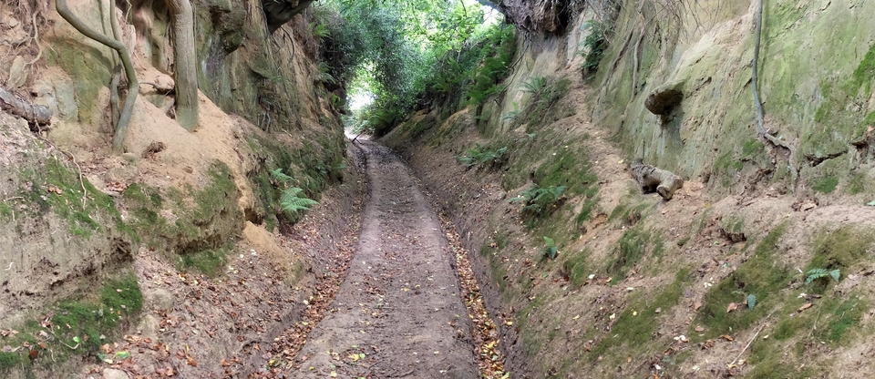
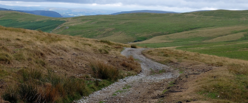
We have 42 versions of #5, and none do the scene justice. The one I wanted to find, but don't think I have, is one showing the straightness and the sudden steepness of the downhill path. And foremost in my mind was: Wagons couldn't have come down here! No brake could have held them. So perhaps it is a very ancient road, before wagons: a road for man and horse. And for cattle. But – another thought – even man & beast on foot would have left a deep hollow way…and there wasn't one. Not more than a yard deep…
If it wasn't for Bryant's map and those hawthorns, I'd suspect Bucks County Council had made up the whole route for tourists. Then I had a third and nastier thought: this may not have been the original track at all. I had remembered the story of the farmer's wife on the tractor… This would account for the straightness and the lack of a Holloway.
Oh well, it's wonderful scenic route. Not necessarily a drovers' route, but drovers were thick on the ground in this area, on their way to Aylesbury via Dead Man's Lane1.
* * * * *
April 2023: I had an email few weeks ago that hit me below the belt. First, the lady who wrote was remarkably complimentary about the website, and secondly she is a direct descendant of the legendary stockman, George Simms of Denham Farm, Quainton.
I never met George because he died before I became interested in Drovers; but I met his son, who explained his father’s reputation clearly. He said that George could lean on a gate, look at the cattle two fields away and mutter, “Something wrong with that brown and white ‘un”. Then he’d point out the bullock to his boy, who would bring the beast down from the field – and by Heaven, there was something wrong. It was magic to anyone else but normal for George.
George grew up driving his father’s cattle to market in Bicester, Thame and all over Bucks. I sort of knew all that, but what I didn’t know was that we were walking across George’s Land, Denham Farm. Don’t know why I never asked the name of his farm, because I was always asking questions: Geoff Cheshire, now sadly dead, was my favourite contact. He used to career around in a Pony Trap and loved to talk.
According to my correspondent, George hired a water-diviner to find all the springs on his farm then plumbed in troughs to water the animals – as well as the farmhouse. My correspondent goes on:
“Cattle reared on that land make remarkable meat not just because of the lush grazing, but they are also drinking fresh mineral water and such steep climbing builds natural, slow, high-quality muscle and fat. He was, in his own words, 'steward of that land' (insisting we never 'own' any land because it belongs to God) from around 1950-1998.”
I have to agree with that last sentiment. And what belongs to God we are bound, by God’s law, to improve, not waste or defile.
I said at the start that the email had hit me below the belt. Well it certainly has, because I am now full of nostalgia for the green fields and lanes of England.
Thank you to my correspondent for her generous and illuminating words.
* * * * * *
We fuelled ourselves up for the return with a pint & some chips at The George & Dragon, sitting on the Green looking at the windmill. Highly recommended. Then got severely lost on the way back. We found help, though: at Denham Farm!
1 The Northampton Mercury for 17th Aug 1796 reports that the Grandborough [sic] Enclosure Committee decided on a 40' Carriage & Drift Road from the village down to Dead Man's Gate and thence to Hogshaw & Quainton... North Bucks Way, I presume. But our route was older than 1796.