The A413
Buckingham may have had ten fairs in the 18th century, but they were probably local in nature: the town's communications with the outside world was lousy. ‘Lousy' is not the word The University of Buckingham uses in its excellent history of the town, but the message is clear: the Ouse was unnavigable and good roads out of town barely existed, so it was hard for industry to expand.
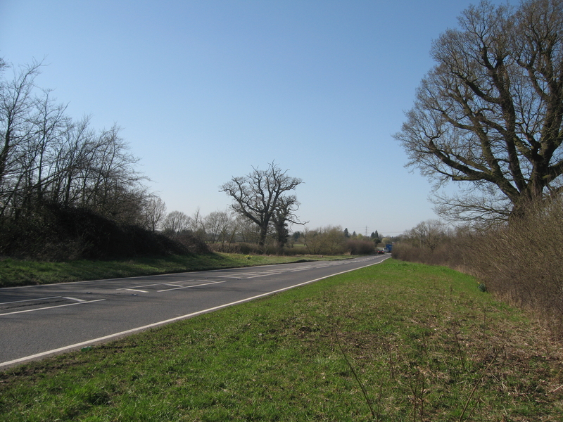
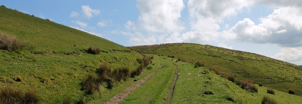
Then came the turnpike – what we now call the A413 – in 1722, driving majestically (#1) north west from Wendover through a gap in the Chilterns to Aylesbury, and all was changed. It has been written that the Cobham family, owners of Stowe Park, gave the initial impetus for the road because they wanted an easier journey to London. I think this unlikely because (a) the road started from the London end and (b), as Ed Grimsdale points out, the bridge over Padbury Brook (SP 713 315) was not built till 1741. So Buckingham and Lord Cobham were stuck in the sticks till then.
NB After Aylesbury, energy seemed to run out. Thereafter, the road borrowed the route of the old road - see Padbury-East Claydon page. The present Winslow-Buckingham stretch wasn't built till (perhaps?) the 1770's.
Nevertheless, the road gave a huge impetus to trade in general, and in particular to droving. The huge verges acted as "long acres" for farmers with limited grass to put herds out on. There are few laybys, hence only one picture of the width (#1), but the generosity of verge continues through Aylesbury & beyond.
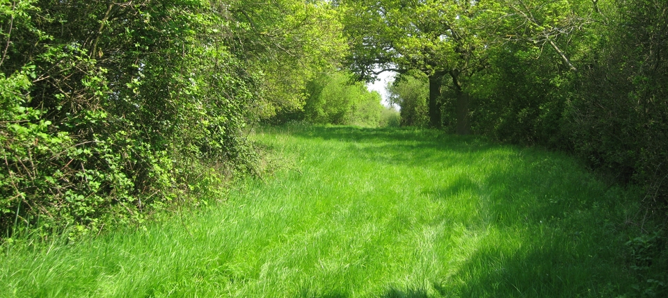
Even better, the A413 was accompanied on its way through the Chilterns by the river Misbourne. This clear, shallow chalk stream (#2) provided water for man and beast for over 20 miles, from Great Missenden to Uxbridge, and was usually only a field's width from the road. It must have been a lifesaver. (I took the picture during a drought in March 2012, so the river looks Miserable rather than -bourne.)
(Reminder: each beast needed between eight to ten gallons a day, and the drovers' biggest headache was providing it. The headache grew more painful still when the route was through permeable chalk.)
The route out of Buckingham led to the setting up of the New Inn at Padbury, the Folly at Adstock and The Ivy House, south of Amersham...and here we come to an oddity. Read on...
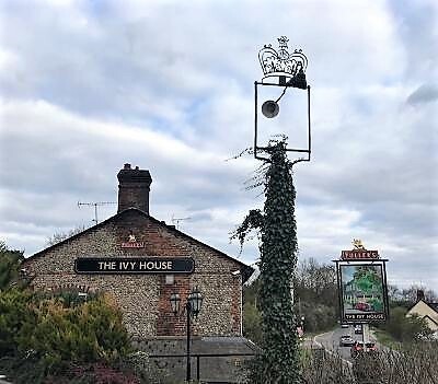
April 2021: we recently met Nick Gammage, either the bravest or the maddest man we have known for a long time. He intends walking (with a tent) from West Pembrokeshire to Chesham Bois on old drove roads. Quiet ones, which makes it harder but with better chance of survival. It's all for charity, and details of the charity and the walk will appear on the website. Meanwhile, he has written a letter about The Ivy House at SU 984957, on the 413 on the London side of Amersham (see #3). I'll paraphrase it:
"I have been puzzled by 18th and early 19th century maps showing The Ivy House Inn (mentioned by Henry Lee Uff as somewhere he stopped for R and R). Those early maps showed The Ivy (Ivey) House on the South West side of the road - but the inn is clearly now on the opposite side - but there are no remains of any sort of building on the S-W side.
"By the second half of the 19th century, OS maps were showing an inn on the North East side of the road (where there is definitely still an inn) and calling it the Rose and Crown. When I passed by the other day I noticed there was also an old disused inn sign along side the current one and it had ... a crown on the top (#3). I made some local inquiries: it seems the inn was known as the Rose and Crown until the sixties when new owners decided to revert to the original name.
"So the first (18th century) map maker just got the location wrong and others simply followed him. Then sometime in the 19th century someone decided to change its name to the Rose and Crown."
[In the Bucks Examiner, April 1916, the inn was "still commonly known as The Ivy House". You can't change a popular name. Look at the ivy crawling up the sign in #3...]
Thanks, Nick.
---------------------------------------------------------------------------------------------------------
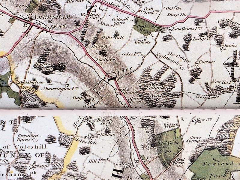
A week after Nick's letter I remembered with a jolt that I had a reprint of the Jefferys map of Bucks (1770 ) and the Bryant map of the same county (1825). In #4 and #5 you can see that, between those dates, the name had been changed. But why? Patriotic fervour? Or would coach passengers be happier to stop under a Rose than under some Ivy? That's probably the answer: come to think of it, ivy hasn't got much 'kerb appeal'.
----------------------------------------------------------------------------------------------------------
December 2021, and the last time I comment on the IH. Nick has found out it was the road that moved, not the Ivy House. I kicked myself because I should have guessed: always trust the mapmakers, Smith!