PB to RT
Perrotts Brook to Ready Token (Welsh Way)
The old route from London to St Davids may have been known by some as "Welsh Way" for much of its length in earlier times, but nowadays the only stretch by that name refers to the 9 miles between Perrotts Brook and Fairford1.
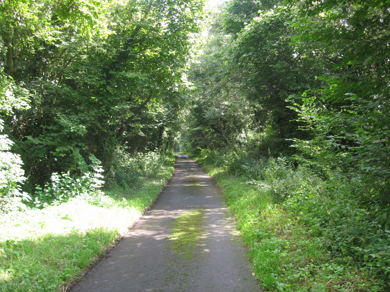
The route crosses Ermine Street (A417) four miles north-west of Cirencester (SP 992071) and then... you are on a six-mile stretch of straight and lonely lane to Ready Token, passing unflustered across more important (Roman) roads on its own little journey, populated on either side by sheep and only sheep. There are no farmhouses and grass grows through the tarmac. The gap between the walls on either side is 40 feet but the little track in the middle is too narrow for cars to pass one another. (After it crosses the Fosse Way at 042056, cars don't even bother.)
The OS map shows the route going through Perrotts Brook (SP 021062) and Barnsley (SP 077051); then Ready Token. What a name! We thought at first that it alerted travellers to the presence of a tollgate on Akeman Street2 where they would need to produce a ticket. But in Jan. 2020 we saw an article from 1851 quoted in Brian Smith's book on The Cotswolds which suggests it was the name of the village inn:
"Now Akeman Street is a lane along which the turnpike milestones remain from the days when coaches stopped at The Ready Token, the inn where cash, not credit, was the rule. A lookout was erected on the roof and when a lumbering coach was spotted 5 miles away, the joint went on the spit, the condiments went into the pot, all ready for the hungry & exhausted travellers..."
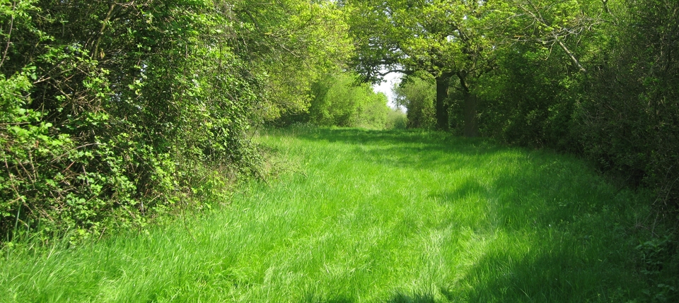
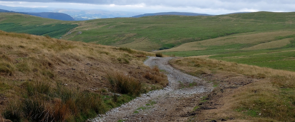
That's as far as I walked on my first visit. Perrotts Bridge (#1), across the delightfully named River Churn, is the site of a Roman settlement and an all-important watering hole in an arid part of England; #2 & 3 are of ‘Shady Lane' as I dubbed it, because tall hedges guard either side like tunnel-walls as it goes gently downhill to Barnsley.
* * * * *
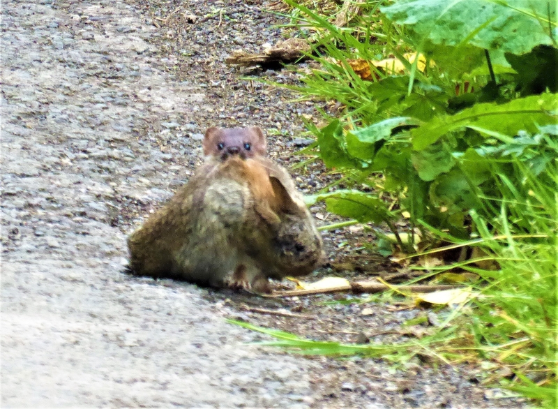
But #4 is a bit special. A stoat had just killed a young rabbit and was carrying it along the side of the road towards us. It had to rest every yard or so because the dead rabbit must have weighed 3 times as much as the stoat. (Chris took the photo, not me.) She had been witness to the murder...But what a testament to the quietness of the road.
* * * * *
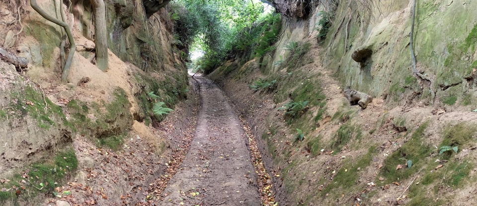
The erosion of the limestone by generations of cattle as Shady Lane debouches on to Barnsley High Street is impressive; Cotswold stone is hard.
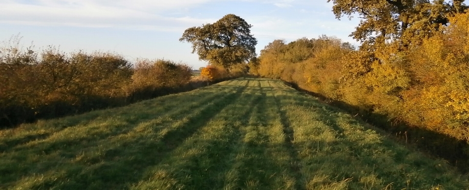
Barnsley is a beautiful village3, but we disdainfully cross ‘The Street', as the main road is known, and find our way round the back of Barnsley House (now a hotel), where there was a ten-acre grazing area for tired beasts which is now used to grow vegetables to supply the hotel's needs. Bet the soil's good! We do a dogleg and join the Ready Token road (#5) behind Barnsley half a mile on, rather than doing anything as simple as following ‘The Street'. Reason: ‘The Street' came with the turnpike in the 1740's and there was a toll to avoid.
On The Street at the north end of the village stands ‘The Old Greyhound', no longer a pub; but it's too smart and too late for drovers; they probably frequented The Queen's Head & the Blackamoor's Head – there were once five inns in Barnsley. Both the QH & the BH were mentioned in 1844, both are lost in time, but both were probably near the ten-acre. The present “The Village Pub” is excellent but a modern invention (1929).
After lunch there I was entertained by the local historian Paul Le Bars, who lives directly opposite the pub and who was as delighted as I was to find a fellow-obsessive. All I've written in the previous two paragraphs comes from Paul.
1 On early maps Welsh Way appears as far west as Middle Duntisbourne. We walked from there but found it too modernised, especially around/under the A417. Bagendon is worth a visit, though, especially its smashing little church. That was another Roman settlement, like PB.
2 There are numerous improbable theories about RT's derivation: for instance when Cromwell was told that all rooms at the inn were "already taken"! There are legends too: about Roman coins & pottery being dug up and human "skellingtons" unearthed at the inn. It's a lonely place...
3 There are separate articles on Barnsley & Fairford below on the Hereford & Glos tab.