Epynt to Erwood
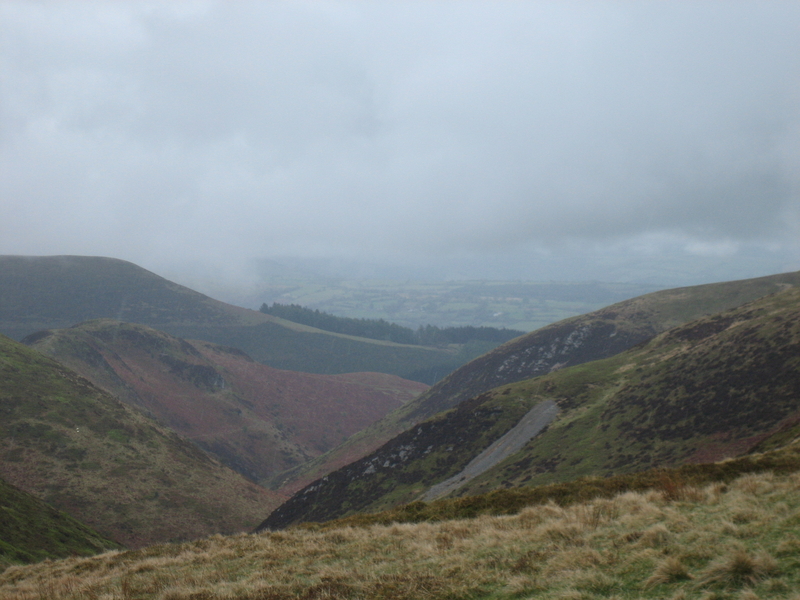
Epynt is a vast mountain south-west of Builth Wells, ‘dull, treeless and gloomy' as Moore-Colyer puts it and made even less hospitable by the fact that it's been an MoD firing range since the thirties. Apparently the (now obviously abandoned) sheep farms used to specialise in knitting thick woollen socks for the drovers who passed over the mountain. The destruction of the Epynt community by the firing range is understandably a source of anger among Welshmen, but life must have been tough up there. Philip Hughes, whom we had stopped on his lawful business to bombard with questions, told us about children on a foggy day – there seems to be a lot of fog on Epynt – guided by parallel lines of white china: the broken crockery carefully laid by parents to guide them on their 7-mile walk towards and back from an education. Then there was the story about the man who rode for a drink to Cwm Owen, lost his way in the fog, released the reins & said to his horse, ‘We're buggered. It's up to you'. Best decision he made that day.
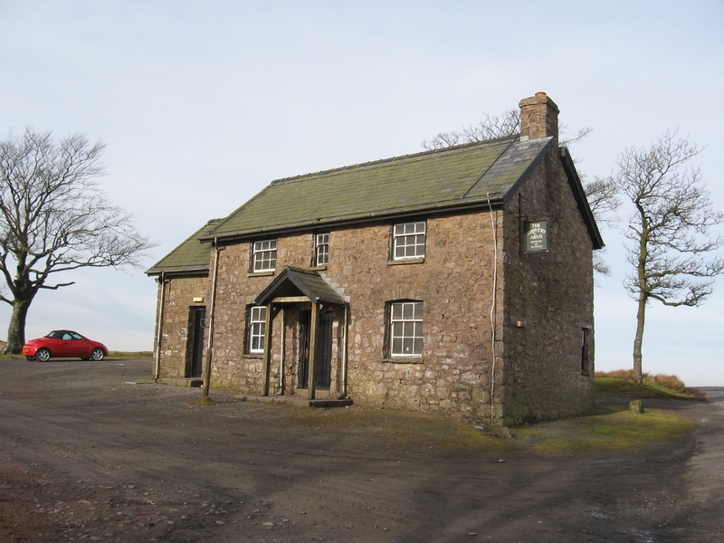
The track taken by the South Wales drovers used to pass just north of Drum Dhu and leads to The Drovers' Arms at SN 986 452. The inn has been kept spotless by the MoD, but heartless too: empty, with bare concrete floors – and of course locked as tight as a military prison. A melancholy little relic of the droving age.
Now which way? We – Nick & Sue Fane & I – wanted to establish which route the drovers most commonly took from the eastern slopes of Epynt down to the ford on the Wye at Erwood. So we started down to The Griffin, a drovers' inn – it's unnamed at 021 442 – on the Builth-Brecon road just east of the mountain. The locals have always called it ‘Cwm Owen'.
JANUARY 2021: thanks to John Wakefield, who emailed me with a picture of the Griffin in 1974, I have done a separate article on the pub. I have also found a long letter from the previous owner, Nigel Channing, that gives more background.
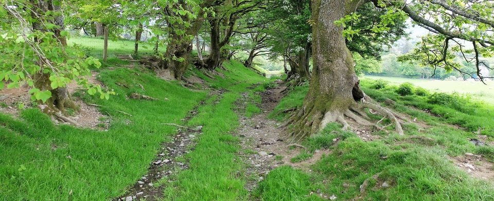
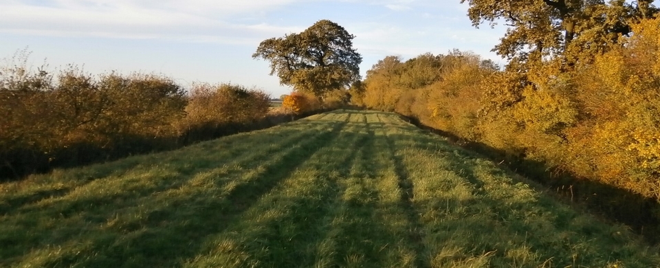
From the Griffin we walked east over the moor and into a more beautiful, world. Above us the blue sky, at our feet the mountain grass, around us a criss-cross of green tracks punching straight lines through the bracken. Richard Moore-Colyer of Aberystwyth University quotes a local historian in his book: ‘the track was ploughed by the hoofs of the cattle in the damp weather,...manured as [the next herd] passed over it...and in the dry weather it would be harrowed by the hoofs...again. No bracken or fern has grown on it since.'
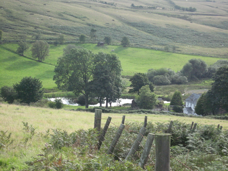
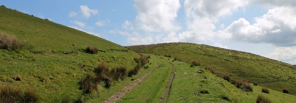
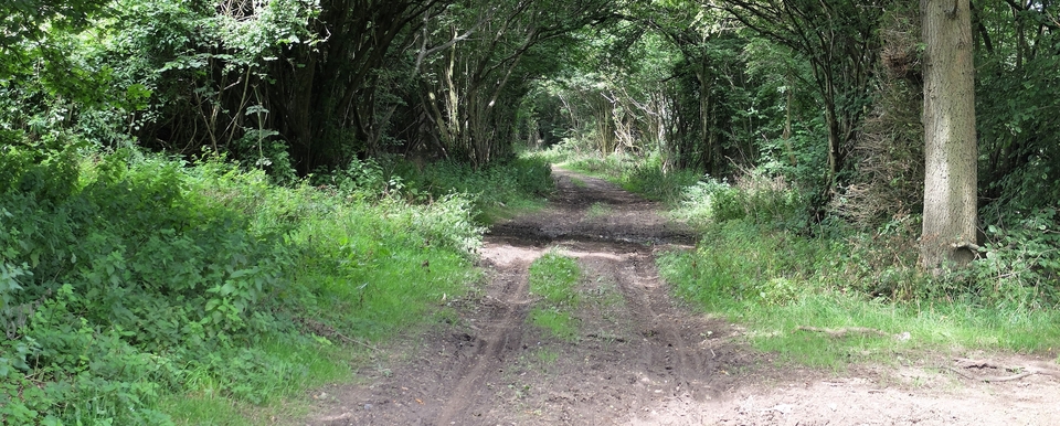
We were aiming for the farm Cwm Gwenddwr (052 445), which R M-C said was on our route. The final descent to the farm was slightly unsatisfactory: it was a make-do affair in which I said something like “let's go round the edge of this field, turn left at the bottom to the farmhouse & ask the way.” Lots of Tigger, not much Owl. The farmer was highly cooperative, in spite of having to contend with what looked like 1000 sheep, and told us how to get up the other side of the valley to the cattle grid (058 445). From then on it would be downhill all the way to Erwood: downhill in both senses, we thought.
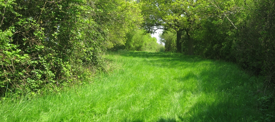
I had to make a phone call at the cattle grid. When I'd finished, I rejoined two glum-looking Fanes. In explanation, they pointed back to the valley the other side of the farm. There, plainly visible now but in dead ground 15 minutes before when I had my Tigger moment, was the most perfect hedge-lined green lane we could have asked for, dog-legging down to the blasted farm. I had assumed there was a piece of woodland ahead; I hadn't dreamt of a hedged lane on those wide open hills. But there it was and the only reason could have been to contain a drove.
I've since been told that the hedge in the picture was probably not planted at all: the whole hillside was wooded before sheep farming tamed it, but a strip of the original wood was left for passing beasts.
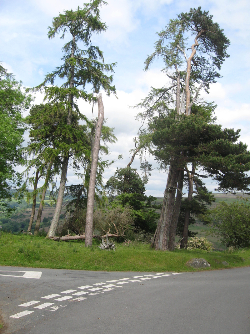
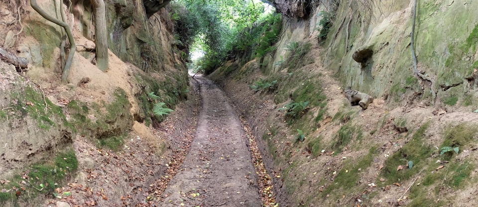
Philip Hughes had told us the original drovers' track went down to Maescletwr, thence to Erwood (‘The Ford' in English). First came The Pines, the waymarker for drovers, where the roads meet at 073 438. Then we came to a provocative bit. Just after the pines we diverged (right) on to a grass path. I quote R M-C: “Known locally as the ‘Twmpath' the lane joins the 19C turnpike road...”, implying that the ‘Twmpath' is a lane. This idea is reinforced by two tall posts, like inn signs, saying ‘TWMPATH' at the start of a green lane through the bracken. But Sue Fane was suspicious of ‘Twmpath': she called it a ‘false friend'. Nick and Sue had looked up the word & found it had no connection with the English path at all – in fact the online Welsh dictionary defines it as tump, hillock or bush. And there are tumps with trees on top, one at 084 433. Moreover, the OS map, which has the word twice, does not print the word in line with the path; it's printed separately as a feature on the landscape. So, ‘false friend' it was.
We reached the main road at Erwood, turned left through the village for half a kilometre, and saw on our right the zigzag grooves the cattle had made down the west bank of the Wye. Here, as the Fanes pointed out, was the crossing used when the water level was low enough for them to wade across. Another half-kilometre further is the bridge over deeper and more troubled water…